


Advertisement
World of Hot Water Ep. #6~ Makin' It Count: Tracking the Yrs of Weaponized Wx
Exactly HOW MANY hurricanes have been Doppler weaponized? The COUNTDOWN begins... join us! Present day to 2010
- Category: Chemtrails / Geoengineering ,DEW, Directed-energy weapon,Microwave / Frequency,WeatherWarfare/WeaponizedWeath
- Duration: 37:42
- Date: 2018-12-02 04:54:29
- Tags: chemtrails, geoengineering, weather modification, climate, engineering, change, steering, hurricanes, radar,
2 Comments
Video Transcript:
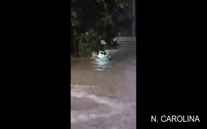
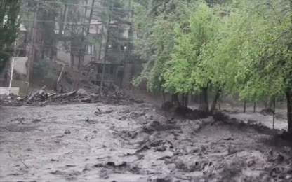
After making my discovery that the eye of all hurricanes making landfall in the United States in the 2017 season, made landfall directly into Doppler radar, and seeing the trend continue into the 2018 hurricane season, where the odd habit of unnatural attraction of eye and radar was repeated for each hurricane that manifested even moving backwards in order to do so for hurricane Florence, we went back in time to see how far back this story may have started. Going deep into the roots of Tesla's wireless dream for humanity, brought to his famous warden cliff tower directly after studying a list of significant tornadoes. Taking a pause from the ingenious inventor and visionary who first discovered the greatest weapon of mass destruction the world had ever seen, we go forward in time to where we left off in our hurricanes trend. Going backwards in time from 2017 to see how many of the hurricanes followed the trend of belining it straight into Doppler radar. We realize that this may be the tedious part of our world of hot water, docuseries, but we have been referring to this as that rather than documentary series because not only is it a documentary, but it is a documenting series. So we are actually entering this into history's narrative, forcing it to answer to these recurring facts. While we continue to explore the various aspects involved with the actual hacking of the hydrological cycle, leaving our viewers with a well-rounded, at least basic understanding of how all our daily moisture is stolen, we will now into the incredible yet, probably slightly boring and monotonous documenting of how many hurricanes going back in time will be interacting with Doppler. And then obviously, direction away. This part may be redundant and boring, but alas, it is being documented. And thus, we ask the thrill seekers amongst our viewers to check back if they do not care for a count of hurricanes, because there are dozens we will capture for history's sake. Those who realize the significance of this documenting may be able to take their own damages to court, or start holding the operators of Doppler radar accountable for their losses. Something that cannot be done with a chemtrail geoengineering argument, because not only can you never prove which chemical came out of which plane, but by the time you do, anyway, chemtrails have been legalized for global warming by Trump. When he signed HP 353, the Weather Research and Forecasting Innovation Act of 2017 into law, geoengineering is now a national security matter, so the argument is dead. Geoengineering cannot be stopped because it justifies itself. The actual definition of geoengineering is the deliberate large scale manipulation of an environmental process that affects the Earth's climate in an attempt to counteract the effects of global warming. And now we know that anything that is alleged to fight global warming is a national security issue, whether it actually fights global warming or helps to make it worse is another issue altogether. But while we're splitting those hairs, explain to me how steering a storm into a Doppler radar or a city is justified in fighting global warming. It is not, and is not only evidence, but proof that weather is weaponized, and as unbelievable as it is for me to say it in my own ears even. Technology has sprung up in our midst right in front of our eyes, and our hydrological cycle has been hacked and hijacked, and a false narrative given to polarized camps so that they can fight each other instead of the water thieves. Thus, sticking to illustrating the historical and statistical impossibility of Doppler radar drawing the eye in for decades is the only hope humanity has of catching the thief before he runs off into the night with a system so sophisticated and so entwined with our current grid of cellular and power generators that it will soon be impossible to pinpoint. What is steering the storms as everything gets hyper localized? But before that window closes in on us. Before that thief runs off into the night, we take the time to enter the following into evidence for the sake of liberating the very soul of humanity from the clutches of those who are daily stealing our moisture and steering our storms, leaving us in a world of hot water. And for those who would offer up the argument that there are many Doppler radars in operation across the continental US, I would agree that there are, but then I would also challenge you to a game of pool. Because anyone will know there's also a bunch of pool pockets. There's six on a table that's rectangular. There's a bunch of balls and when you break them, you are not guaranteed to get a single one in. All right, I didn't make any balls on that red shot. And yet when it comes to the Doppler radar, you can count on it interacting in a directional line with these storms when they come into land. They come into a Doppler radar or they are steered by another Doppler radar. And we can see this with the beams that are supposedly scanning to read the weather. They are feeding the weather. We see this. And so now we take a look at how far back this goes, at least that which we can see preliminarily. So what does it take to track these storms? First of all, it needs to be said that the best way to see the direct interaction with Doppler radar is in real time. That is because that is the only time the product is animated for you. So when there's a storm, you definitely want to capture the animated product because after it airs live, so to speak, it will be archived and you may order it, but it will be in slides rather than animated form. And you will have to do some technical stuff to get the image to become animated. Though we are willing to do this for any storm, we may want to take the court for the purposes of this massive undertaking of researching every storm and realigning history. So that it answers when Doppler radar first got weaponized, I satisfied myself preliminarily with assembling what I could find already assembled on the internet. Landing on some useful radar loops captured by various weather buffs on YouTube, and gathering weather images to help establish the angles of approach and how they relate to the map of the continental Doppler radars. Once you have the track outlined, it's easy to see if it was heading towards a radar site or not. However, nothing shows the interaction as well as having the animated product, which can reveal such things as the direction and length of time that the microwave beams were on. And now, thanks to Leonardo Coleman, who discovered and tested the little trick of putting the radar loop into storm-relative mean velocity mode, before sharing it with me, we can now see precisely how the polarities of Doppler radar sync up with the storm. Unfortunately, we only learned this trick recently, so we do not have it going backwards, at least not yet. But for now, we study what we do have. Let count down. Hear me. And there we have the prolonged beam. Going into KTLH, most definitively, KVAX is a little harder to make out, but it is on the map and it goes for that one as well. And there you have it, folks. So we can do a little studying here. And we'll see that these blooms right here. The stronger they are, the more they are pushing the storm out and away. Now, there will be beams that go in from various ones and you have to order those or watch them in real time to be sure when and which way they are pulsing. But when the whole Doppler blooms out, it is pushing out, just creating high pressure, ridge, in that area. So what we are seeing is they will bring down the blooms right before the storm comes in to allow it to come in. But then if they do not want it to make landfall, they will bloom it out again and it will push out and it will keep moving. So in action, it looks like this. Bloom heavy over here on the east to make a wall, but the ones down on the south and Florida were weakened until well after the storm is passed. Here is one, pushing out. Although it was weakened, this one is definitely weakened. Melbourne, you went in towards Melbourne, then watch this. Melbourne blooms out after its past. And we have Jacksonville. It is hard to see what it is doing as it passes and there is interference between the storm. Again, storm relative mean velocity is the mode in which to capture it best. History, you see, and there you capture the frequencies. When in history has a storm, oh lordy, has a storm ever skirted the entire coast. This is new, this is them having fun with the technology. You know, olives have been through so much, it takes a moment for you to realize it was only a few days ago, Matthew first, a progmudge, it takes a moment for you to realize it was only a few days ago, Matthew first approached their coast. Interesting, graphic, is it not? What is a laser beam in the eye of the storm have to do with anything? Well, we have to begin, of course, with Hurricane Matthew, it is at 5am, so you know what that means? We have the latest advisory, a live radar view as the storm march is slowly north along the east coast of our state. CBS 4 meteorologist, Lissette Gonzalez is here with that new 5am advisory, Lissette. Alright, Walter and Vanessa, good morning to you and to all of you at home, here it is. It is still a category 3 hurricane, a very dangerous hurricane right now. In terms of the radar right now showing Matthew just slamming portions of the space coast, we are obviously missing some of that data because some of the radars may be going down due to the force of the winds. Right now dealing with Hurricane Force wind conditions here along the central and northern coast of Florida, and that will continue. So there it is. So there it is, Matthew going into KMLB, or rather being skirted across the coast, making a loop de loop. You can see here some beam rendering, but we actually kept some frequency here in this picture. So at this point, we don't have any more radar loops without ordering the images, but if you are a victim of Matthews, then perhaps you may want to order the unanimated product and take the pains in time to figure out how to animate it. And perhaps seek damages in court along with your friends if your community was taken out or suffered irreparable losses. Okay, just my recommendation. Anna. Clearly goes into KLTX. It dances around KRAXB for being shoved off. It's going to dance around, but it's going to end up going right into right over KLTX. It gets in line, and then... Oh, shhh. And up to KRAXB, then we're not going to be able to see that clearly in this loop. And WUSH. Bill. I'm not even going to narrate this one. You can clearly see it's over the dopper. This is Texas. Arthur. Here we are with the center of the eye, according to our calculations, only 11 miles from Cape Lookout there. The question is whether the center is going to hit Cape Lookout or not. If it does, then technically you get a landfall there. It's moving at 15 miles per hour. Let me just put it into motion here. Well, quickly, and you'll see, it's... You look at the center, exactly where is the center going to go. It's going to come very, very close to Cape Lookout. It's the center of this circle. And is that center? Let me... Let's see what? Let's go close up here. So here's the circle. It's like this. And is the center of that over top of that little bit of land. If the hurricane center analyzes, that's the case. It looks like it might be a little bit west. Anyway, if that moves over the land, then that's... That is landfall. So right here is the National Weather Service, KMA checks. KMA checks. And right about here in... ...field fort. As we're Arthur, Made Landfall. Pitch. It's right about... ...sun even. It's both right here. It's right about here. So, I didn't go right over it this time. And... But yeah, I was just going into it. So, something could have pushed it out at the last minute. But it was going into KMA checks. And as you can see here, there's no other Doppler's or in between. That's pretty close. Or the eye to be coming in here. It was driven into this, at least until the last minute, when they put on the brakes. Isle. So, I'm going to go back to the last minute. I'm going to go back to the last minute. I'm going to go back to the last minute. I'm going to go back to the last minute. I'm going to go back to the last minute. I'm going to go back to the last minute. I'm going to go back to the last minute. And... Andrea. In May have been an undesired one. May have been a year they were trying to avoid storms altogether. I don't know if they control the entire cycle. Or if nature still peeks through its own agenda sometimes when no one is working it themselves actively. So, this may have had an agenda, or they may have turned it into an agenda. But the only storm that has been a year, the only storm that makes landfall that year, is basically going in right here. And does seem to be going between... Like they put it between the Doppler radars maybe if they don't really need it any more than that. But I don't know, that's me assuming things. They say it's making its way this way, but we actually see it touching on K-Jacks and then going up to KCLX. So, yeah, it does huff curves around there. More or less. Here we capture the beams. Let's feed the moisture. More beams. Interesting rendering of the beams there. And we do have a K-J-A-X radar. And you can see that it touches it and then moves off briefly. So... Isaac. Okay. So, the thing about lining up the track map, like we have here for Isaac, as opposed to using the live feed, the radar feed, the radar loops, is that you miss out a lot of the action. This is their final analysis of it. Preliminarily, Isaac seems to have actually, though he got close to New Orleans and the K-L-I-X and the North Shore, and it just sat in New Orleans for days. And actually, Isaac means I laughed in Hebrew or in ancient language. That was why Abraham's wife named her child that when she was beyond child-rearing years. And the angel Raphael came to tell her that she would have child, she laughed, east-hawk, Isaac. I laughed. And the irony of this was they gave us this for the anniversary of Katrina, seven years after Katrina. We get an anniversary present called Isaac. And the funny thing about it is it just sat in New Orleans for a few days. The people were much better prepared the second time around. They were more resilient, they were more hearty, they were community oriented, they pulled together, and they pulled through the way it should be, actually. But now, even though the storm was going near it, it did not touch it. And in fact, if you look over here, seems to be skirting around the range of Doppler. Pulling in, pulling in, pulling, it's like it's pulling into KSRX. Maybe KSRX pushes it out some, and then it goes up here. It's pretty much missing all of the Doppler radars. It's going between all of them. So in this case, this is an instance where the storm is repelled from the centers. For whatever reason, I'm not sure what the objective is, but noticing it misses all of the Doppler radars. Unless we get an animated product that shows us otherwise, now let's look at this. So Isaac sat. Insat. Insat. Ooh! That was KLIX, sending that beam. Feeding it out that way, okay. Rallyed it out there. Now there's another beam. I'm sure that came from. That builds up the moisture. Another beam. I'm not sure quite sure where that beam comes from. And this is where you see it going in Northeast Louisiana, and then it jumps. See, it's going into the Northeast. Is it? Oh no. It didn't really, the eyes stayed in the middle. And then the beams. Now there's not a lot of detail in these graphics. The loops are better when you go online than when you look at whatever they show you on the television. There it is. And they. And the storm right there. So essentially it's coming into KLIX until it blooms out and then it goes around it. There you go, the land. But it was coming into it. Loomed out there. Sprite into and then around KLIX. Sandy, the Frankenstorm. Right in here for Sandy, we have her coming up. She's pushed out here. There's a big push out. Right, not giving a room to go there, but then brought in, even though she was going around that way. She came in this way. And then makes right turn a 90 degree angle and just goes up north and they came in. So let's see here. This is going into KDIX and right at KCCX. Guess what? We have a turn. And a draw up. It's very interesting. Okay. Okay, and here we have a radar loop. Not as fancy as our modern day ones, but still very revealing in the S&P. Here we have a storm going right over the... Right over the Doppler radar within a... Within a mile. Pretty much over. Frankenstorm. And they called it Frankenstorm. Those are not my labels. Franken means manmade. They're not even mine. Right in there. Right in there. Busted. Irene. Great. So here we have Irene. And you can see she crosses over here. Just KMAX. Right then gets drawn into... She's skirts along here. Lands around in there. You can check out K-O-K-X. And although it does look like it's a little bit on the western side of K-O-K-X. That's the New York one. And then I don't know. Not sure. It's not up in here. Doesn't seem to go into K-Box. It was K-G-I-K-G-Y-X. Not sure. We'll find anything for this. But let's check it out. So the approach to KMAX-X. KMAX-X is actually not where it's written on that map. It's within the rectangle there. A little dot is KMAX-X. And as you can see, the storm... Storm goes over it. Skims it. The landfall is right by KMAX-X. We're curved into meat it. And on its way, up to the New York Doppler. It's pretty close. Then we get closer than that, really. Just a little, a mile off center from the Doppler. And here we are, York City Doppler. Sending it on its way. 2011 was also the year that dual polarization was first successfully used during Hurricane Irene. That is the official record. And I can only imagine. Well, dual poll has the potential for dramatic improvements in rainfall estimation. Still more testing and refinement is needed. For maximum improvement throughout the US. Dual poll precipitation estimates for Hurricane Irene and Eastern North Carolina seem to perform better than the existing precipitation estimations, which are based on radar reflectivity alone. Compared both storm total precipitation graphics to their network of rain gouges. Though preliminary, forecasters at the Newport Morehead City forecast office feel that the dual poll product performed better than the older product, in some cases, several inches better. This is very encouraging, given that this is the first hurricane scanned by an operational dual poll radar in the US. The added shlatter. He continued with the potential for dramatic improvements in rainfall estimation with dual poll is great. But there's still much testing and refinement to be done so that a maximum improvement is achieved all across the US. Well, to be continued for further research. I'll see you next time. Bye. Funny. And that is the eye going over KAMX. My clockwork. My clockwork. At 4 p.m. 2100 dc. The center of tropical storm KAMI was located new attitude 24.5 NW. Longitude 97.0 west. KAMI is moving toward the North Northwest near 15 miles an hour. And this general motion is expected to continue for the next day or two. End of note in the year of the BP oil spill 2010. The continental US is fairly limited in its storms. There's one that approaches from the Mexican border and it is a tropical storm and then depression. Okay, that's number eight remain. And Bonnie dips in and is killed somewhere around New Orleans. KLI X. So they don't let it come into the, it just stops right there right on the water, right on the land. So, okay, that was convenient. Let them clean up the oil spill, huh? For the most part. Some people said that there was industry opportunities and whether modification services sold to industry in order to minimize the upster of the oil. They used corrects it to sink the oil. They were trying to limit their liability and it was all about not clean up but cover up. And it's reflected here. Quite clearly. We pause now to take a break from our count of Doppler weaponized hurricanes. Just as we have paused in our retelling of Tesla's tail of wireless power and directed energy weapons, for in weaving the fabric of the tail of the water-thieving that has sprung up in our midst, we must cover or recover a lot of lost and stolen ground. Stay tuned for the continuation of our countdown as we explore how far back our story of steered storms and directed energy goes and how atmospheric rivers were created and now are being steered. We'll learn how the pseudo-scientific community gets away with touting CO2 as the driver of these storms and why water vapor has anthropogenic causes despite what is absent from the official narratives. If this is your first time with us, we encourage you to catch up on the other shows. And if you are a returning loyalist, hungering for the rest of the story, we ask you to stay with us and check back as this channel and work is heavily censored and shadow-band. There are many people whose entire careers were propped up to discredit, detract, and distract from this very message before it ever got discovered and put forth, but not one who can debunk it. If you do not share this information, it will not get out. So please like, subscribe, share, and check back regularly to make sure you're not missing out on a world of hot water. To be continued...